North Asset Tech logoNORTH ASSET TECHINC

See properties differentlyUnderstand every change

Historical aerial imagery and GeoAI that show what changed on a property, when, and by how much. We also manage properties with the same technology.
Get a demo   Explore data capture

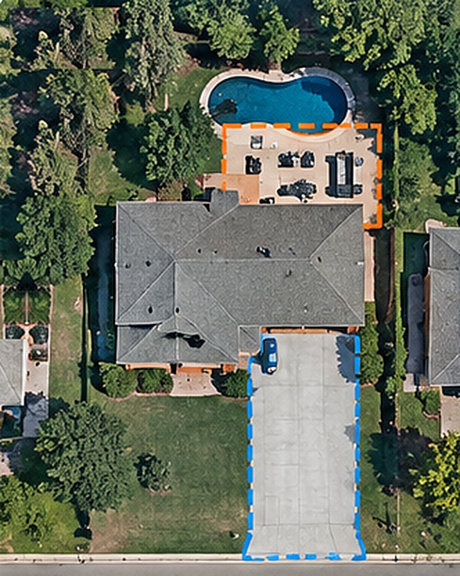
Aerial view of a residential property in 2021
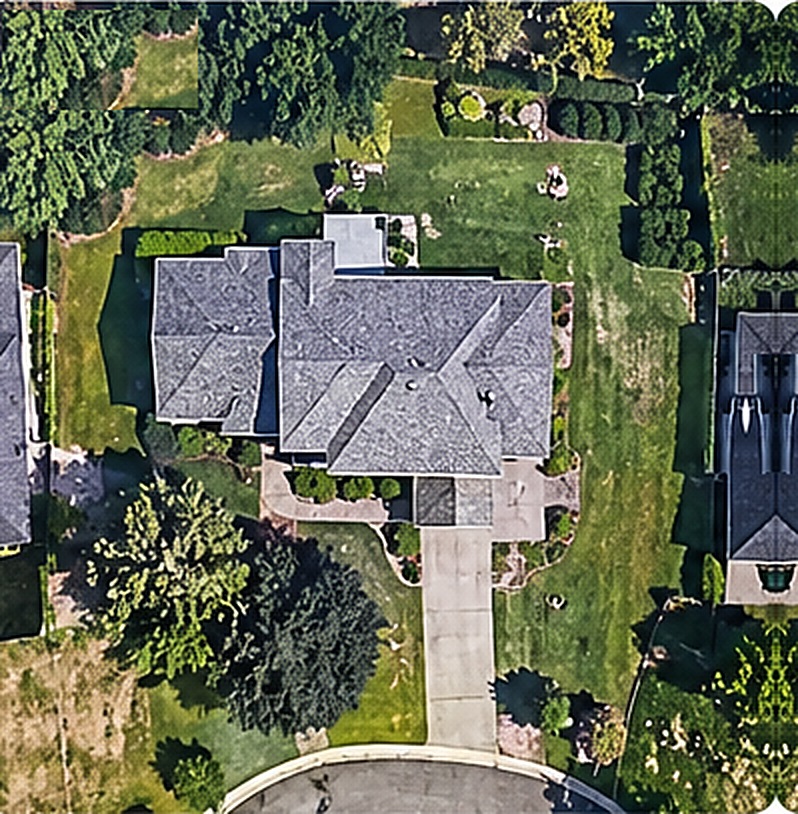
Aerial view of a residential property in 2024
20212024
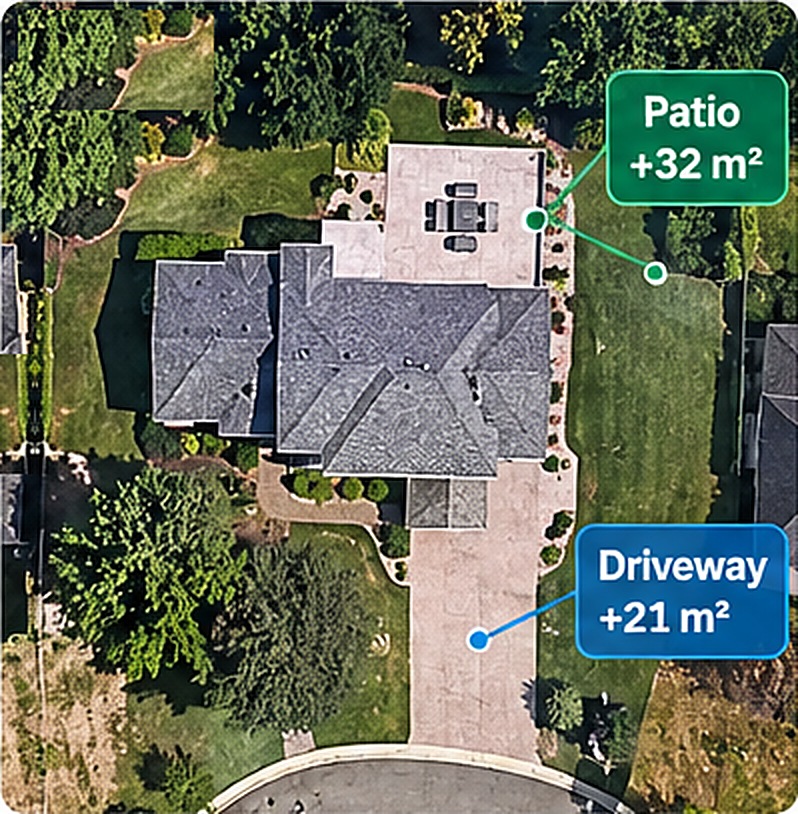
Detected change: driveway (+21 m²) and patio (+32 m²)Potential increase: 53 m²

DATA CAPTURE

Aerial imagery today and, from 2027, ground-level data from a mobile mapping vehicle and drone.

AI ANALYSIS

GeoAI extracts buildings, roofs, surfaces and changes automatically across whole portfolios.

m²

MEASUREMENT

Areas and changes are measured and delivered as reports, GIS layers and exports.
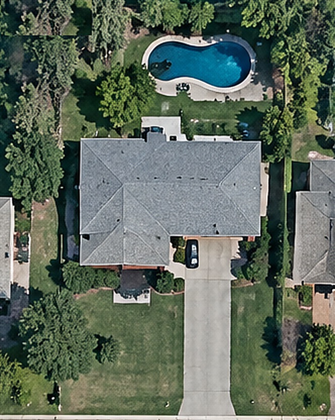
Aerial view of a property with a pool in 2021
Aerial view of a property with a pool in 2025
20212025
Driveway+21 m²
Patio+32 m²
Total hard surface+53 m²

Property intelligence from the record of what was there

Compare historical and current aerial imagery to identify additions such as driveway extensions and patios. In municipalities where stormwater charges reflect measured impervious area, these changes can affect a property’s assessment.

  • Driveway Expansion
  • Patio Construction
  • Impervious Surface Increase
  • Detailed Area Measurements

Solutions

From historical imagery to day-to-day property management, one connected set of services.

Property intelligence and change detection

Compare any two image dates. Find new roofs, extensions, driveways, patios and removed vegetation, with areas in square metres.

Historical imagery and spatial records

Aerial imagery by year, linked to parcels, so each property has a visual history your team can review and export.

GeoAI feature extraction

Buildings, roofs, driveways, roads, pools, tree canopy, and impervious and pervious surfaces, delivered as GIS-ready layers.

Property management using tech

We manage residential and commercial properties, supported by digital inventories, map-based portfolio dashboards, inspection records and maintenance priorities.

Real estate investment intelligence

Land-use history, neighbourhood growth, surrounding property changes and site screening to support investment decisions.

Portfolio dashboards

Every property on one map, with imagery, building details and maintenance history, available to owners and teams.

Industries We Serve

From historical imagery to day-to-day property management, one connected set of services
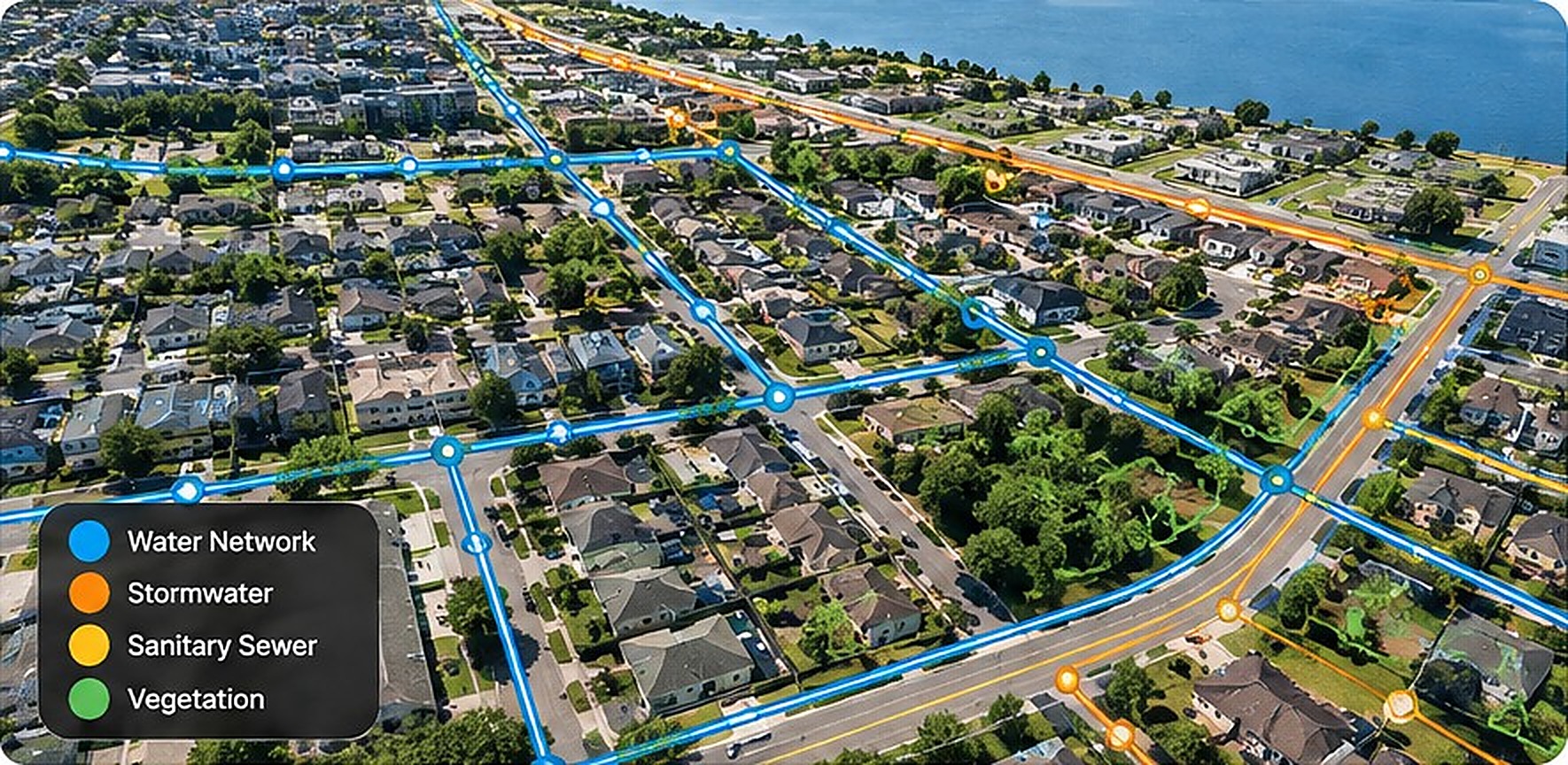
Municipalities

Municipalities

Find property changes without a site visit
  • Hard-surface and stormwater analysis
  • Building footprint and roof changes
  • Development and bylaw monitoring
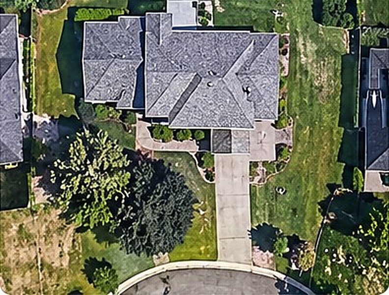
InsuranceRoof conditionTree overhang

Insurance

Screen portfolios by property condition
  • Roof history and changes
  • Vegetation and drainage context
  • Before and after event comparisons
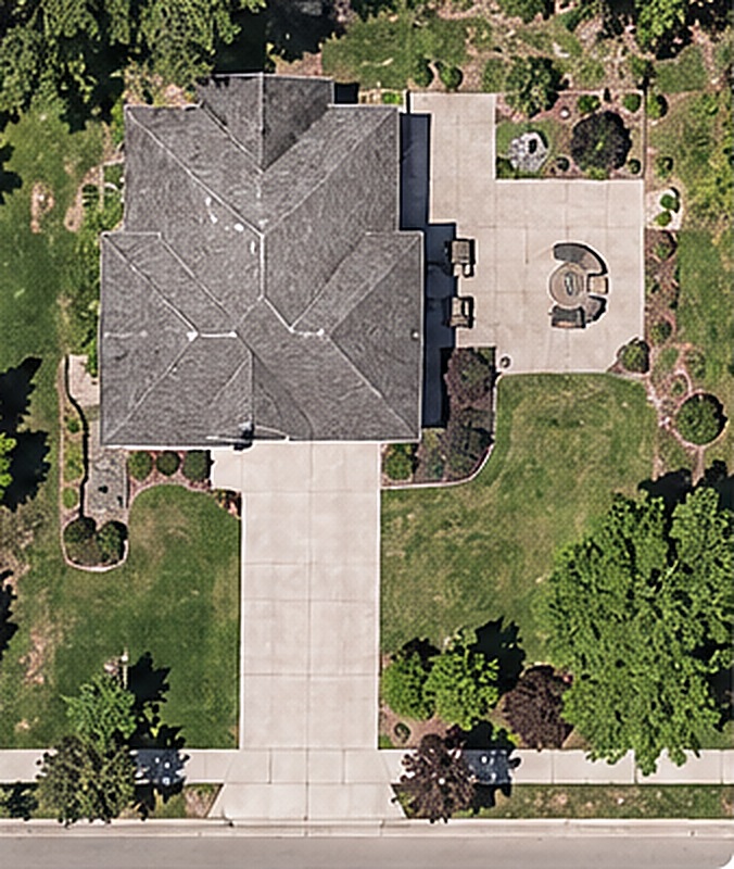
Real estate and property managementParcel recordMaintenance priority

Real estate and property management

Know a site’s history, then run it well
  • Land-use and building change history
  • Residential and commercial management
  • Inspections, maintenance and portfolio dashboards
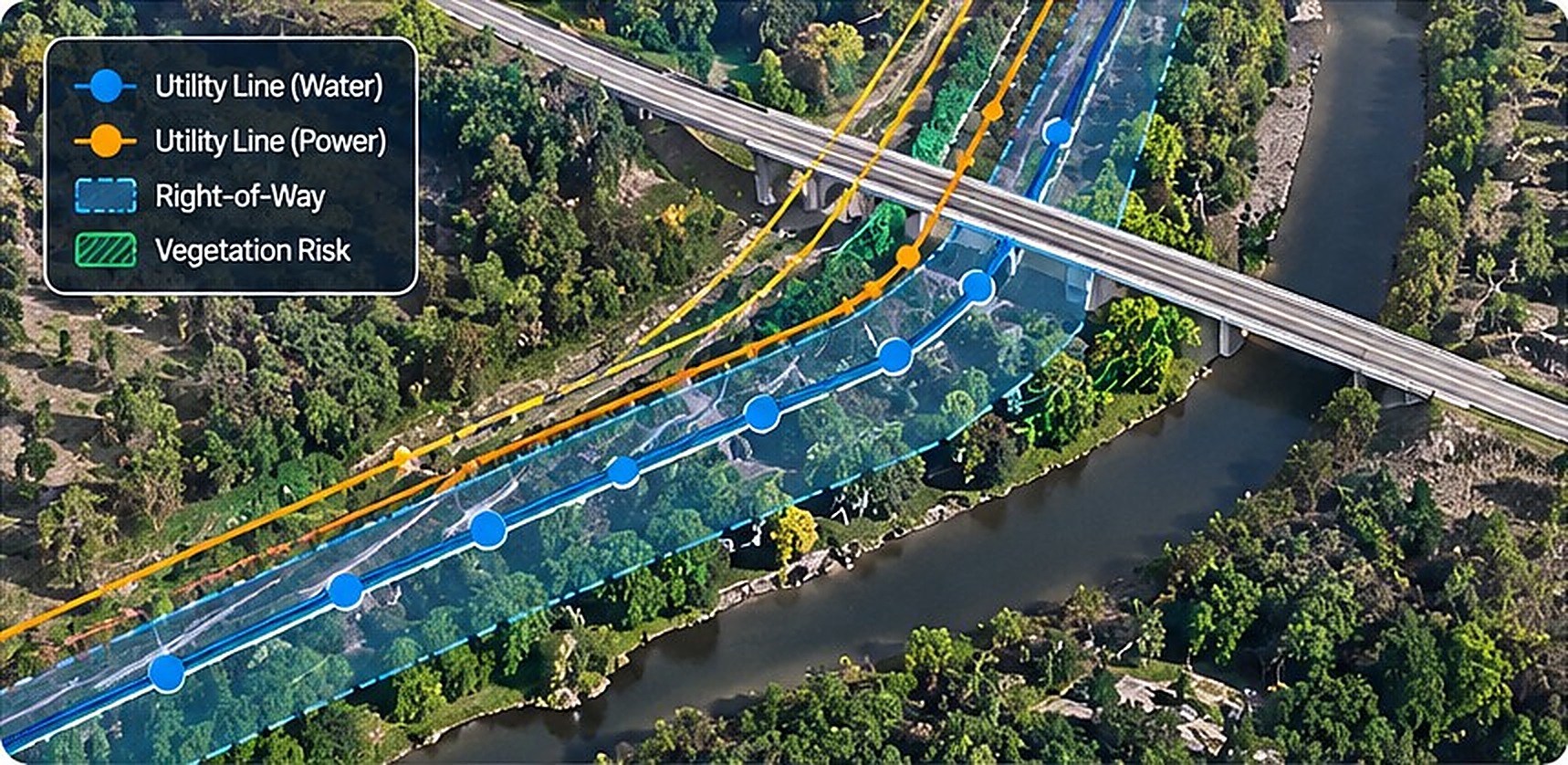
Infrastructure and utilities

Infrastructure and utilities

Monitor corridors and assets from above

  • Utility corridor monitoring
  • Asset inventory
  • Vegetation analysis
  • Right-of-way compliance

Property management, run with technology

North Asset Tech is also a property management company. We look after residential and commercial properties for owners and investors, and we use our own geospatial tools to do it better.

  • Day-to-day management of residential and commercial buildings
  • Inspections with photographs, linked to each building on the map
  • Roof, parking and pavement monitoring from aerial imagery
  • Maintenance prioritization and capital planning
  • Owner dashboards covering every property in one place

Request a management proposal

North Property Intelligence
Property map with detected changesPatio +32 m²Driveway +21 m²
Change reportPrevious hard surface 145 m²Current hard surface 198 m²Potential increase 53 m²

North Property Intelligence

A property-level platform for teams that need to know what changed, when and where.

  • Search by address or property identification number
  • View historical imagery by year and compare two dates
  • Detect changes in buildings, roofs, driveways and hard surfaces
  • Measure the area of each change
  • Download PDF reports and export Shapefile or GeoJSON
  • API access for enterprise customers

Log in to the platform   Get a demo

Built to fit your GIS workflow

ShapefileGeoJSONPDF reportsCSVGIS layersREST API (enterprise)
Available from 2027

Data capture on the ground and in the air

From 2027, North Asset Tech, together with its partner, NavMobility Inc., will collect terrestrial data using a mobile mapping vehicle and our upgraded drone. Ground-level and aerial data will feed the same analysis platform, giving property and infrastructure owners an exceptional, complete view of their assets.
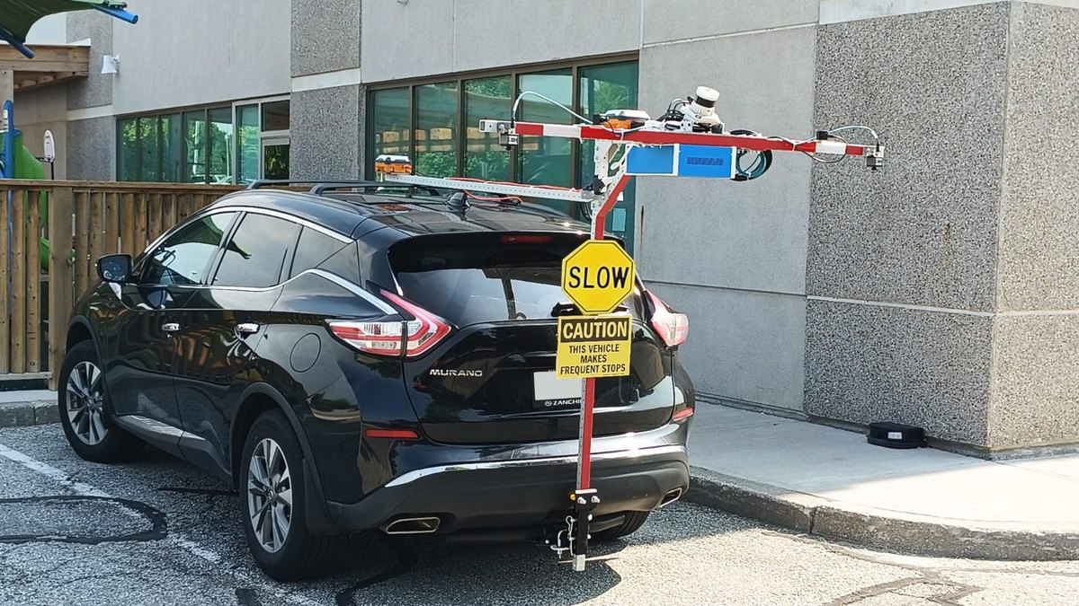
  • Mobile mapping vehicle for ground-level data
  • Upgraded drone for aerial capture
  • One platform for aerial, drone and ground data
North Asset Tech vehicle-based mobile mapping platform
Vehicle-based mobile mapping platform
MunicipalitiesInsurance CompaniesEngineering ConsultantsProperty Owners

One company, three divisions

North Intelligence

GeoAI and property analytics: change detection, feature extraction, impervious surfaces.

North Property Solutions

Property management using technology: digital inventories, GIS dashboards, inspections and portfolio analytics.

North Spatial Data

Imagery and geospatial services: historical records, data processing, mapping and custom datasets.

Accuracy you can verify

Every detected change links back to imagery that your team can inspect and confirm.

Automation that scales

Our processing handles everything from one neighbourhood to tens of thousands of parcels.

Spatial expertise

Experienced geospatial specialists stand behind every delivery.

Talk to North Asset Tech

Request a demonstration or describe your property intelligence requirements. We reply within two business days.

Email:

Client portal

Sign-in is provided to registered clients. Request access and we will set up your account.

Request access